Chora was the only settlement of Astypalaea until the 19th century. The other settlements that are spread around the island now-days were founded in the previously arid and uncultivated areas. The largest among these are Livadi and Analypsi or Maltezana and were established during the Italian occupation (1912-1943). But of course most of the populace is still concentrated in Chora. It is built on a peninsula with two wonderful bays on its sides. As we look towards the sea the bay on our left is Pera Yalos and the one on the right is Livadi. The rugged coastlines of Astypalaea give us an idea of the broken terrain that dominates the entire island. The island on the map resembles a butterfly with its wings open. A narrow strip of land that is just 10 metres wide and is known as the “steno” (=narrow strait) located approximately in the middle of the island connects the two sides of Astypalaea; the eastern side of “Mesa Nisi” (=inner island) and the west side of “Exo Nisi” (=outer island).
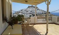
Here is the capital of the island. It is built on a hill which ends in a peninsula that creates two bays: the port of Pera Yalos and Livadi Bay. We can see on the hill's summit the shiny white steeples of the Evangelistria and Aghios Georgios churches standing out from within the dark castle walls that are made of local stone. All around the castle are little white houses with wooden balconies and blue-painted doors and windows and several churches and chapels among them. Further adding to the beauty of Chora there are eight windmills on the hill's saddle. Walking on from there we come up with the traditional coffee shop and a little further we find the Town Hall from where two main streets begin and reach up into the Castle on the hill. Each of those two streets ends to one of the major churches; one to the Monastery of Panaghia Portaitissa on the Livadi Bay's side and the other to the Church of Megali Panaghia on the side of Pera Yalos.
Although the Astypalaean capital of 'Chora' has expanded and seems to be united with the picturesque Pera Yalos now-days, it still constitutes a separate settlement that stands out for its infrastructure in tourism. Pera Yalos was the main port of the island until the recent construction of the Aghios Andreas port while a modern marina has been constructed that is fully functional today and combined with the restaurants, the cafeterias and of course the sand and the crystal waters will more than satisfy. Pera Yalos is also the place from where the tour boats that will take you to the wonderful beaches of Livadia, Tzanaki, Moura, Pappou and 'Aghios Konstantinos' are launched.
Located along the coast on the inner side of the bay that carries the same name, Livadi is the island's flowerbed. A most fertile village with gardens of vines, mandarin and orange trees and houses dressed in veils of flowers. Livadi is located approximately 1,5 km close to Chora and is a rapidly developing area where, as most of the island's visitors would attest, the nicest beach of the island is to be found with fine pebbles and sand. There you will find several spots were you can rent canoes, sea bikes and small boats.
A village located in a valley in the Outer Island (Exo Nisi) along a beautiful sandy beach. Vineyards and orchards reach as far as the serene sea. The village's alternative second name 'Maltezana' draws its origins from the pirates that used to loot around the Aegean and then looked for a safe haven in these beaches where now small fishing ships are docked along the village's waterfront. Tour boats offer visitors the opportunity to cruise along the island's beaches and the islets of Hondro, Ligno, Aghia Kyriake, Koutsomytis, Syrna and Kounoupi. The mosaic of the zodiac circle and the important ancient Mathematics of Talaros can be found there. There is also a mosaic in the courtyard of Aghia Barbara (=Saint Barbara).
 Koursaros brings you the latest fashion and accessories for women, men and children. Be inspired by our ...
 AstyCar based in Astypalaia Greece, has been in the car rental business for the last 25 years. Our long ...
 In a comfortable and friendly environment overlooking the unique castle of Astypalea, with extensive ...
 Kyrannos Rent a car welcomes you to sunny Astypalaia, an island of unique and unforgettable experiences. ...
 In our store you will find a variety of decorative and souvenir shops as well as all sorts of furniture and ...
 At Patisserie "Zafora" you will find a wide selection of fresh pastries as eklerakia, triangles, kokakia, ...
 "In Style" is your one stop shop in Astypalaia, for all the latest styles and trends. Updated daily ...
 After four years of operation, we have gained the experience and the ability to have a wide variety of ...
 Astypalea yachting providing services in skippered yacht chartering. We decided to finally make our dreams ...
 "Mediterrenean Frogs-Lymberis" is a new diving center in Astypalaia Island, founded by Lymperis ...
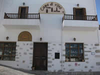
 In our store, Casa di vino, you can find the "ΚΕΡΑΝΘΟΣ" products, always created with traditional methods ...
 ...
...
 Kyrannos Boat & Yacht Services, based in Pera Gialos, Astypalaia Island, Dodecannese, Greece, is an ...
 Delmadoros Boat & Yacht Services, based in Pera Gialos, Astypalaia Island, Dodecannese, Greece, is an ...
 Daily trips to Astipalean beaches and nearby small islands.
Koutsomiti - Kounoupa - Kaminakia - Agios ...
 Astypalea is one of the most beautiful islands of the Dodecanese and waiting to be discovered. AGGELIDIS ...
 Astypalaia rent a car vergouli is the best car rental company in Astypalea.We can offer a big variety of ...
 The company was founded 15 years ago to meet the needs for full service in the removal and storage area, ...
 Το εργαστήριο παραδοσιακών προϊόντων Ηλιάνα ιδρύθηκε το 2007 και λειτουργεί στην Χώρα της Αστυπάλαιας. ...